
Glaciers 18th - 19th January |
|
|
|
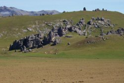
The Kura Tawhiti boulders on the way to Arthurs Pass |
|
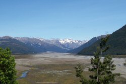
A view of Mount Franklin as we neared Arthurs Pass | |
|
Wendy feeding a Kea at Arthurs Pass village | |
|
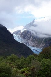
Our first view of Franz Josef glacier | |
|
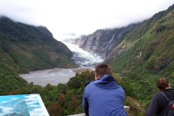
Franz Josef Glacier terminal from Sentinal Point. The board to Wendy's left shows how the glacier has receded and advanced over the years. We worked out that the current position of the terminal is very close to where it was when Jo's parents were here in 1960 although it has receded and then advanced quite a distance in the interim. | |
|
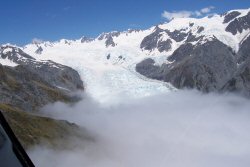
The top of Franz Josef glacier from the helicopter with low cloud covering the view down. | |
|
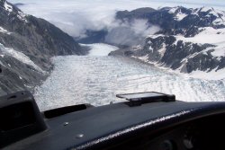
The view down Fox glacier | |
|
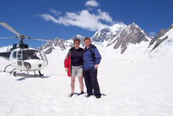
Us at the top of Fox Glacier with our helicopter and Mount Tasman in the background. Mount Tasman is the second highest mountain in New Zealand at 3497m. (We did get a peak at Mount Cook, but only a very blurry photograph) | |
|
Another view looking down Fox Glacier - the blue colour is really vibrant. | |
|
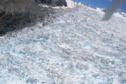
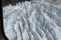
A glacier is actually a frozen waterfall - this is the glacier just as it is "falling" over the mountain. | |
|
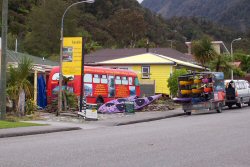
This bus was actually an internet cafe. | |